Back
hike
Back
hike
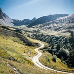
Walking loop of the Roue valley
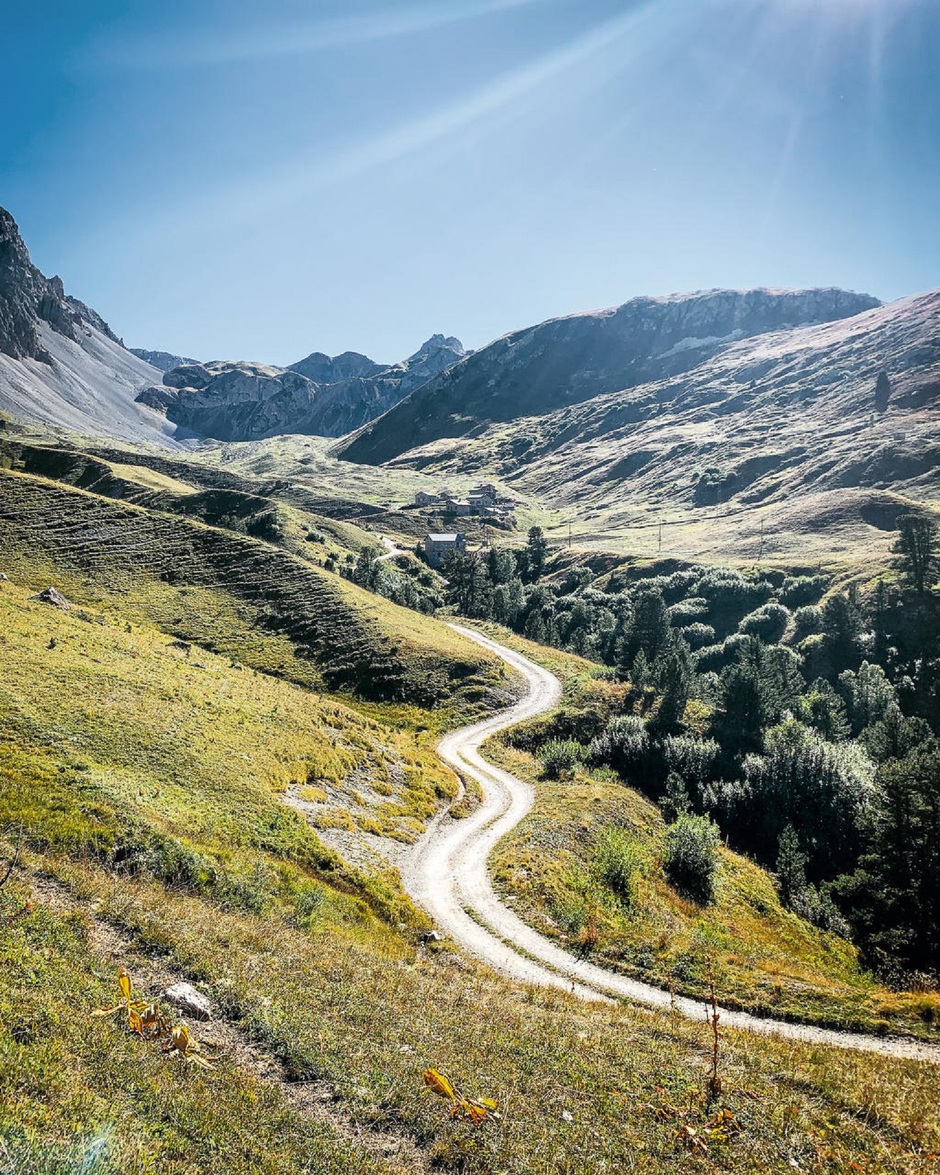
Take a round trip around a characterful valley. Stroll along the luminous foothills of the Valfréjus ski resort to discover a little-known facet of Haute Maurienne.
Description
You gradually ascend to a high-altitude meadow shared with herds and playful marmots. The countless peaks seem to touch the sky with their jutting edges. On your right, hidden behind a low grassy ridge, the Thabor refuge may be your next objective. But now it's time to turn east. Did you know
that you're arriving at the foot of the Italian border? At an altitude of 2287 m, the Memory Trail connects you with the area's military history.
A fascinated glance at the Col de la Roue and you're off to tackle the main difficulty of this hike. Between Petit and Grand Argentier, 25 switchbacks up and 19 down... what better way to blend in with the chamois? Enjoy a refreshing break at the Pas du Roc.
You've done well to overcome this pass, which served as a natural barrier to soldiers. I promise you, if you keep your eyes peeled all the way to the hamlet of Jeu, you'll see the remains of the Maginot Line military barracks dating from the 2nd World War. On the trail back to the Lavoir, you may be overtaken by enduro mountain bikers. No doubt about it, you've explored
a site reserved for mountain enthusiasts.
Additional welcome
The duration of hiking trails is calculated using reference paces: 300 m/h ascent, 500 m/h descent and 4 km/h on the flat.
As hazards may occur at any time on the routes, the GPX tracks provided are not contractual. They are given for information only. Riders use them at their own risk, depending on their level of technological proficiency and their understanding of the terrain.
-
Minimum age: 14
Environments
-
 Mountain view
-
Mountain location
-
Presence of livestock and guard dogs
Rates
Free access.
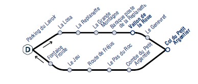
Itinerary
-
 Distance
15.2km
Distance
15.2km
-
 Route type
LOOP
Route type
LOOP
-
 Elevation gain
900m
Elevation gain
900m
-
 Negative gradient
900m
Negative gradient
900m
-
 Daily duration
05h30
Daily duration
05h30
-
 Signposted itinerary
Yes
Signposted itinerary
Yes
-
 Beaconing accuracy
Mixed markings (PR: yellow blades and GR; red and white)
Beaconing accuracy
Mixed markings (PR: yellow blades and GR; red and white)
-
 Nature of the land
Rock,
Stone,
Ground,
Not suitable for strollers
Nature of the land
Rock,
Stone,
Ground,
Not suitable for strollers
-
 Maximum altitude
2635m
Maximum altitude
2635m
Opening period
Daily from July 1 to October 1.
Subject to favorable snow and weather conditions.
Additional opening
-
Subject to favorable weather
-
Subject to snow conditions
Documents

Animals
Pets allowed : Yes
Pets allowed with supplement: No
Pets allowed on leash only.
Guidebook with maps/step-by-step
-
To guide you in the field, consult the "step-by-step" directional diagram provided in pdf.


-
Distance
15.2km
-
Daily duration
05h30
-
Elevation gain
900m
-
Negative gradient
900m