Mount Tabor
Mount Tabor, the Three Kings
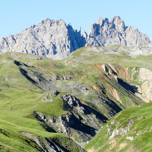
We're in France, not Galilee! At the foot of the Three Wise Men's chain, which dominates the valley (Gaspard, Melchior and Balthazar), stands Mont-Thabor at 3178m. A chapel has even been erected on the summit of Mont Thabor. This chapel (closed since summer 2021 for renovation) is the destination of a major pilgrimage in summer.
At the crossroads of the Maurienne, the Vallée Etroite and Névache, Mont-Thabor is nevertheless an isolated site in a "high mountain" coomb softened by the presence of the Sainte-Marguerite lakes, which also offer a lovely hiking destination from Valfréjus.
Between France and Italy
Le Thabor is a border area. On the border between Savoie and the Hautes Alpes, between France and Italy. In the aftermath of the Second World War, the peace treaty of February 10, 1947 ratified the rectification of the Franco-Italian border. As in the case of the Mont-Cenis plateau to the north and the Chaberton summit to the south, the border was extended from the Col de l'Echelle to the Rois Mages range, including the upper part of the Vallée Etroite. These areas, which had been Italian, became French. Ancient milestones can still be seen in this area. An unusual heritage to discover.
Hiking
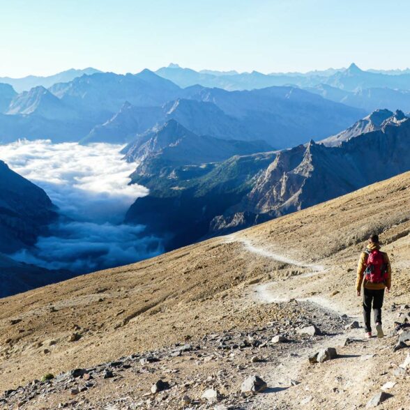
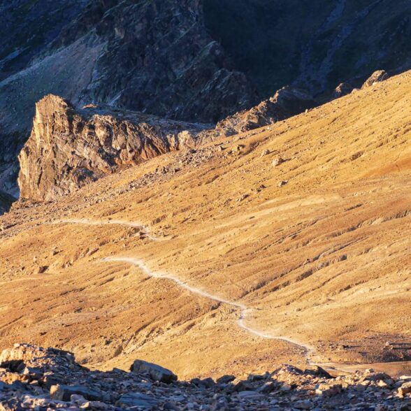
A 3000-metre summit accessible to all in summerFrom Valfréjus or Le Lavoir, the Thabor massif is a hiker's paradise. A wild route winding between lakes and scree slopes leads to a superb summit where the mineral landscape becomes lunar, and the panorama exceptional on prestigious summits: Grandes Jorasses, Cervin, Grande Casse, Mont Viso...
Reaching an altitude of 3178 metres, the summit is easily accessible in summer, without special equipment (snow is still often present in early July, so check with theTourist Office before setting off). What's more, with its remarkable geological history, Mont Thabor is a mine of natural treasures. Let yourself be surprised!
Please note: although the hike is not particularly difficult, it is fairly long (allow a full day for the return trip). The easiest way to complete this two-day hike is to spend the night at the Thabor refuge.
Start/finish: parking du Lavoir, Valfréjus
Difference in altitude: +1255 m/- 1255 m
Distance: 20 km

The Narrow Valley
a wild, unspoilt valleyValle stretta for our Italian neighbors, this is a magical place! Pass from France to Italy without even realizing it! Take the road that climbs from Modane to Valfréjus (6 km), then on leaving the village, follow the signs for Le Lavoir. The road is passable but remains an unpaved forest road. Leave your car in the parking lot at the foot of the Lavoir barracks (and stock up on cheese on the way back, as this former barracks of the "Maginot Line of the Alps" houses a cheese dairy that produces alpine Beaufort all summer long) and take the famous GR5.
From Modane station, you can also take the bus to Valfréjus and then walk from the station along the Route du Lavoir. The walk through the forest is very pleasant, especially in high summer.
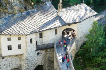
The Charmaix chapel in Valfréjus
Top 5 winter activities
Top 5 After Ski activities