Back
hike
Back
hike
Mont-Thabor hiking trail - Stage 2 - Round trip to Mont-Thabor from the refugedu Thabor
Treat yourself to a wild change of scenery in the high mountains, with their majestic mineral landscapes. You're close to the border with Italy, and if you've ever dreamed of doing a 3,000 m but never dared? Then Le Thabor is waiting for you!
Description
This stage requires a good level of fitness and can be optional if you make a return trip from the Thabor refuge.
Additional welcome
You must book your overnight stay in a refuge in advance. Stay on the trails, following the signs, and take your garbage with you.
Environments
-
 Mountain view
-
Mountain location
-
Panoramic view
Rates
Free access.
Itinerary
-
 Distance
14.7km
Distance
14.7km
-
 Route type
Round trip
Route type
Round trip
-
 Elevation gain
975m
Elevation gain
975m
-
 Negative gradient
975m
Negative gradient
975m
-
 Daily duration
06h00
Daily duration
06h00
-
 Signposted itinerary
Yes
Signposted itinerary
Yes
-
 Beaconing accuracy
Departmental yellow and red/white (GR) markings
Beaconing accuracy
Departmental yellow and red/white (GR) markings
-
 Nature of the land
Ground,
Not suitable for strollers
Nature of the land
Ground,
Not suitable for strollers
-
 Maximum altitude
3162m
Maximum altitude
3162m
Opening period
Itinerary accessible outside snow periods and subject to favorable weather conditions. Check the local weather forecast in real time up to the day of departure.
Additional opening
-
Subject to favorable weather
-
Subject to snow conditions
Location
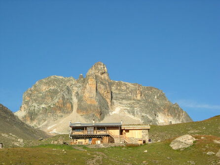
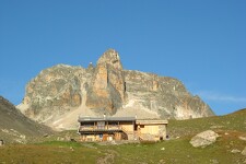
Departure from the Thabor refuge for an out-and-back ascent and a second night at the refuge.
Animals
Pets allowed : Yes
Pets allowed with supplement: No
Pets are allowed on this route.
Guidebook with maps/step-by-step
-
2/ Ascention du Mont-Thabor - Optional stage.
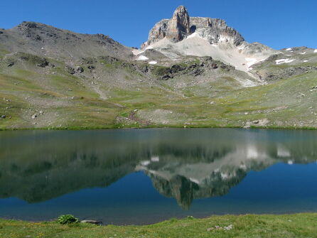
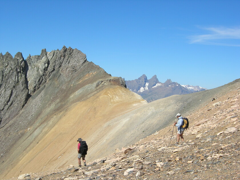
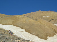
From the refuge, return to the Col de la Vallée Etroite, then leave the GR 5 heading downhill towards the narrow valley to traverse the magnificent high-altitude meadows. Cross a few large boulders on a short descent to reach the colorful Lac du Peyron, and follow its north shore. Skirt the rocky bar overlooking the lake, then continue onto the grassy plateau of Les Chances du Peyron at the foot of the rocky Grand Séru needle. The route then leads to the Col des Méandes, from where the final slope to the Thabor begins. Just before reaching the summit, take a short break at the chapel of Mont Thabor (ND des Douleurs), a pilgrimage site where Italians and French gather every summer. Return to the refuge by the same route.


-
Distance
14.7km
-
Daily duration
06h00
-
Elevation gain
975m
-
Negative gradient
975m