

 Back
hike
Back
hike
Refuge du Thabor - Wild weekend - 2 or 3-day hike
Treat yourself to a dramatic change of scenery in the high mountains, with their majestic rocky landscapes. You’re close to the border with Italy, and if you’ve ever dreamed of climbing a 3,000-meter peak but never dared? Then Le Thabor is waiting for you!
Description
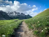
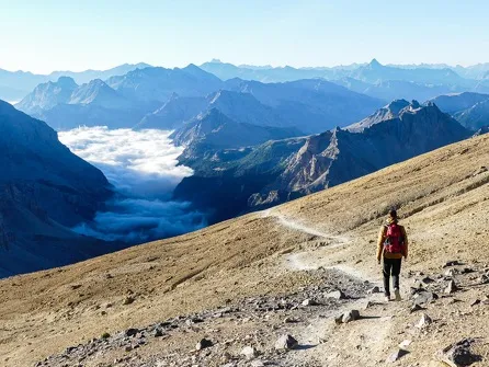
Leaving the Lavoir, the first ascent on a track is a little steep, but you'll soon forget all about it when you reach the Loza water intake. The path winds through the alpine pastures, from chalet to chalet, amidst Tarines chewing on soft grass and wild flowers.
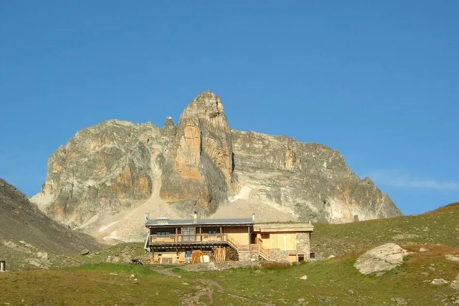
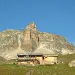
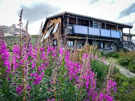
Planted at the foot of Mont Thabor, which serves as its backdrop, the refuge, which will be your base camp for the night, quietly awaits you on the shores of Lac Sainte-Marguerite and Lac Long.
If some of you dream of climbing to the summit, you'll have to get up early tomorrow morning. Make sure your calves are strong enough to tackle the Thabor.
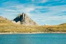
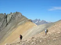
After the Col de la Vallée étroite, Lac Peyron and the Col des Méandes, the slope becomes steeper and the atmosphere more lunar. But the fullness of the site envelops you as you make your way to the chapel, like the French and Italian pilgrims who gather there every year.
The view from the summit is fantastic, embracing the highest peaks in the Alps, from Viso to La Meije.
You'll return to the refuge with your head full of grandiose images, filled with the serenity of these giants of stone. The rest of the group will be waiting for you to start the descent on the other side of the Charmaix stream... another great trip to share with family and friends.
Additional welcome
You must book your overnight stay at a mountain hut in advance. Stay on the trails, follow the signs, and take your trash with you.
Environments
-
 Mountain view
-
Mountain location
-
Panoramic view
-
30–40 minutes by car from a train station
Rates
Free access.
Itinerary
-
 Distance
28 km
Distance
28 km
-
 Route type
One-way ticket
Route type
One-way ticket
-
 Elevation gain
1755m
Elevation gain
1755m
-
 Negative gradient
1755m
Negative gradient
1755m
-
 Roaming time
3 days
Roaming time
3 days
-
 Signposted itinerary
Yes
Signposted itinerary
Yes
-
 Beaconing accuracy
Departmental yellow and red/white (GR) markings
Beaconing accuracy
Departmental yellow and red/white (GR) markings
-
 Nature of the land
Ground,
Not suitable for strollers
Nature of the land
Ground,
Not suitable for strollers
-
 Maximum altitude
3178m
Maximum altitude
3178m
Opening period
This route is accessible outside of snow season and is subject to favorable weather conditions. Check the local weather forecast in real time up until the day of departure.
Additional opening
-
Subject to favorable weather
-
Subject to snow conditions
Labels
Location
After crossing the resort of Valfréjus, climb up towards the gîte d'étape Les Tavernes. At the hairpin bend, take the right-hand track leading to the wash-house parking lot.

Animals
Pets allowed : Yes
Pets allowed with supplement: No
Pets are allowed on this route.
Guidebook with maps/step-by-step
-
Departure point: Parking du Lavoir in Val Fréjus.
1/ DAY 1: from the "Lavoir" to the "Refuge du Mont Thabor" / Time: 2h45 / Elevation gain: + 591 m / From the Lavoir, follow the GR 5 for a few switchbacks along the carriage path. At La Losa, next to a small reservoir, the path splits into a crow's foot. Leave the right-hand route to Les Sarrasins and continue on the GR 5 to the Col de Vallée Etroite (2434 m). At the Col, turn right to reach the Thabor refuge, where you can spend the night. 2/ DAY 2: from the "Refuge du Mont Thabor" to the "Lavoir" / Time: 1h15 / Elevation gain: - 594 m / From the refuge, the path leads into the Combe Grande Montagne and gradually descends to the Mounioz chalets, before reaching the Plan, then the Lavoir.
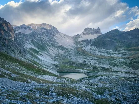
3/ ASCENTION DU MONT THABOR / Round trip time: 6h / Altitude gain: + 907 m and - 907 m / From the refuge, return to the Col de la Vallée Etroite, then leave the GR 5 heading down towards the narrow valley to cross through magnificent high altitude meadows. Cross a few large boulders on a short descent to reach the colorful Lac du Peyron, and follow its north shore. Skirt the rocky bar overlooking the lake, then continue onto the grassy plateau of Les Chances du Peyron at the foot of the rocky Grand Séru needle. The route then leads to the Col des Méandes, from where the final slope to the Thabor begins. Just before reaching the summit, take a short break at the chapel of Mont Thabor (ND des Douleurs), a pilgrimage site where Italian and French pilgrims gather every summer.


-
Distance
28 km
-
Roaming time
3 days
-
Elevation gain
1755m
-
Negative gradient
1755m


-
Valfréjus
 hike
hikeMount Tabor 3-Day Hike - Stage 1 - Fr...
- Distance 5.2km
- Daily duration 02:45
- Elevation gain 587 m
- Elevation loss 1,755 m
-
Valfréjus
 hike
hikeMount Tabor 3-Day Hike - Stage 2 - Fr...
- Distance 7.8 km
- Daily duration 01:15
- Elevation gain 192 m
- Elevation loss 781 m
-
Valfréjus
 hike
hikeMont-Thabor Hiking Trail - Stage 3 Ro...
- Distance 14.7 km
- Daily duration 6:00 a.m.
- Elevation gain 975 m
- Elevation loss 975 m
-
Valfréjus
 trade and service
Fromagerie du Lavoir